


Scientists claim that there is a point at which data begins to resemble a verdict rather than a trend. For the Arctic, that moment may have already passed.
The results of NOAA’s 2024 Arctic Report Card, which was created by 97 researchers from 11 different countries, were released late last year. These findings typically go unnoticed during year-end news cycles, but they most likely shouldn’t. The headline, stripped of all scientific hedging: the Arctic tundra is no longer pulling carbon out of the atmosphere. Carbon is now being pushed in. The tundra has reversed after trapping greenhouse gases in frozen soil for thousands of years, and the rate at which this change is occurring is what’s keeping scientists up at night.
The last nine years are the nine warmest on record in the Arctic. That’s not a coincidence or a statistical quirk. It suggests a more structural phenomenon occurring in the area, a type of acceleration that is challenging to simulate and even more challenging to stop. The Arctic is warming about four times more quickly than the rest of the world, and this difference is beginning to manifest in ways that go far beyond temperature measurements.
Over the past two to three decades, there has been a 65% decline in caribou herds, which have shaped the cultures, diets, and seasonal rhythms of Indigenous communities throughout northern Alaska, Canada, and Russia and have defined this landscape for millennia. The big inland herds continue to decline. Rain-on-snow events — where precipitation falls as rain and then freezes into a shell over the ground — are becoming more common, locking out caribou from the very plants they depend on to survive. It’s possible that some of these herds won’t recover within any meaningful planning window.
Meanwhile, beavers are moving north into Alaskan tundra, transforming waterways that no previous generation of wildlife managers planned for. Satellite photos taken years apart show that the Batagaika crater, a permafrost megaslump in Siberia, is doubling in size. These are not isolated outliers. They are points of pressure on a system that is changing more quickly than the maps that safeguard it can be updated.
That is the real-world issue that scientists are currently facing. Arctic wildlife refuges, conservation corridors, and protected zones were established based on past conditions, such as animal migration routes, permafrost storage areas, and winter ice formation locations. These circumstances are unstable now. According to Twila Moon, deputy lead scientist at the National Snow and Ice Data Center, a new normal is not being created by climate change. With no steady baseline to plan around, it’s causing constant, quick change.
In late 2024, the European Space Agency’s Climate Change Initiative released a new high-resolution land cover map that provides some of the most detailed Arctic terrain data ever created. It maps soil moisture gradients, wetlands, and shrub types at a resolution of 10 meters. It is a noteworthy technical accomplishment. However, it also shows how diverse and erratic the landscape has become, with dry, wet, and moist zones coexisting in ways that previous, coarser maps were unable to depict. At the kilometer scale, 66% of the Arctic landscape is highly variable. A cartographic footnote is not what that is. In terms of where protection truly works, it is crucial.
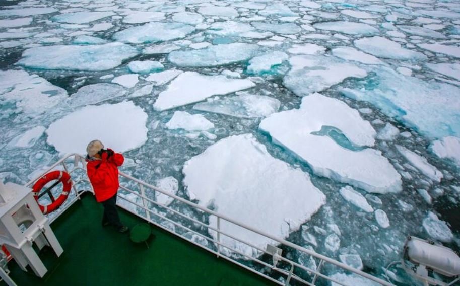
Researchers believe that the conservation frameworks developed around the Arctic over the previous few decades presupposed a level of geographic permanence that is no longer the case. Sanctuaries that were created to safeguard particular species corridors or permafrost zones that store carbon are currently functioning under circumstances for which they were never intended.
In some areas, the tundra is becoming an emissions source instead of a carbon vault due to permafrost thawing and releasing methane that had been trapped underground for generations, as well as wildfires burning at scales and frequencies never seen before. Since 2003, emissions from circumpolar wildfires have averaged 207 million tons of carbon annually. It’s difficult to accept that number.
Though it’s hard to say for sure, it’s becoming more obvious that the Arctic will need adaptive management tools, which react to ecological data in real time rather than set boundaries. Indigenous knowledge is crucial to that endeavor, according to a number of scholars, not as a symbolic inclusion but rather as the kind of place-specific, long-observation understanding that formal science has occasionally lacked in northern regions. The communities that relied on these landscapes the most were the first to notice the changes.
There will be a redrawing of the Arctic sanctuary map. It’s already taking place. The more difficult question is whether it can be completed quickly enough to preserve what is left.
