


It is rare for Elbert County, Georgia, to make national headlines. It is primarily an agricultural county near the South Carolina border, with long, low poultry houses that stretch back from the tree line on either side of the roads. However, in January 2025, the state’s first confirmed case of highly pathogenic avian influenza in a commercial poultry operation occurred there, something Georgia’s agriculture industry had been dreading for years. 45,500 breeder hens in a flock. One test came back positive. And a domino effect that, before the majority of people had even heard the county’s name, reached trading desks in Taipei, Seoul, and Mexico City.
The nation’s largest producer of chicken is Georgia. That is a significant difference. The dense, interconnected network of farms, hatcheries, processing facilities, and feed operations that runs through the state’s rural center is known as the “poultry corridors,” and what happens there has an impact that extends far beyond state boundaries. Thus, the response was not limited to the Elbert County area when the USDA verified the outbreak. It was layered, coordinated, and, in some respects, purposefully controlled.
It’s important to comprehend the subsequent flight restrictions. Movement restriction zones, which are concentric rings surrounding an infected site where the movement of live birds, poultry products, vehicles, and personnel is strictly controlled, are established in accordance with standard USDA and APHIS protocols for highly pathogenic avian influenza. There is a real biosecurity purpose for these zones. They have sound scientific foundations. However, advocacy organizations have long questioned what else is restricted in the process, and the Elbert County case brought it back into sharp focus.
The FAA has been under pressure from a coalition of photojournalists, legal organizations, and advocacy groups to reject a different but related proposal that would allow large livestock operations to limit drone flights over their facilities.
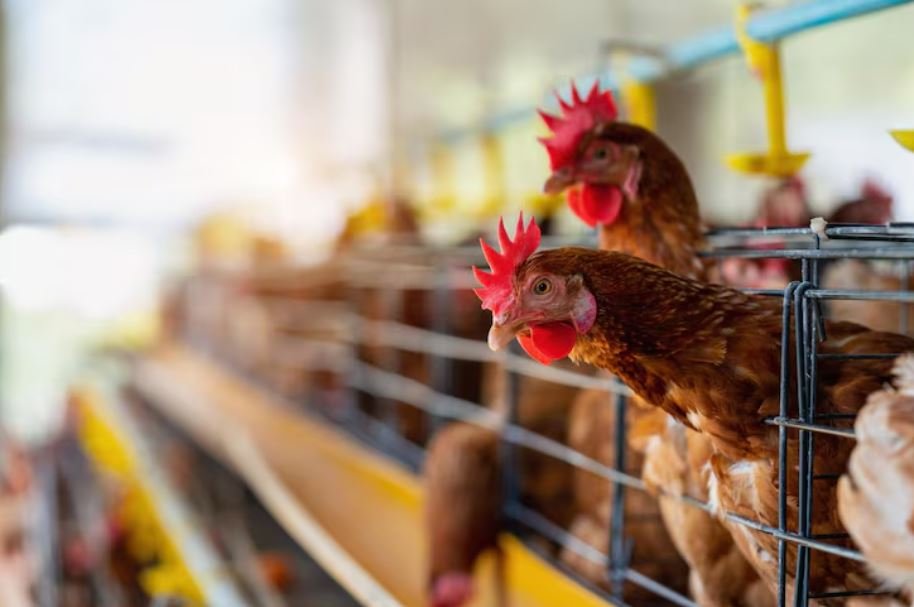
The organizations contend that aerial photography is one of the few trustworthy methods for recording ground-level events, such as manure spills, illnesses, and housing practices, at operations that don’t exactly lend themselves to external scrutiny. They claim that permitting operators to establish no-fly zones over private agricultural land is a transparency issue disguised as a safety precaution. Even though the legal environment in this area is genuinely complex, it’s difficult to ignore their point.
The Georgia outbreak had a rapid impact on trade. It was anticipated that purchases from Georgia would be suspended for a few weeks by Mexico, the single biggest consumer of American poultry products. Taiwan predicted a six- to eight-month ban. About 28 days after the virus was eradicated, South Korea announced it would lift restrictions; industry analysts predicted this would take three to four months. The initial export losses were estimated by the USA Poultry and Egg Export Council to be approximately $34 million. China was not included in that calculation because it had already removed Georgia’s poultry from the market after blocking it since 2023 due to a different waterfowl case.
Observing all of this, it seems that the system functioned as intended—quarantine zones were established, travel was restricted, and trading partners were informed. However, the extent of the disruption caused by a single outbreak at the county level is remarkable. It felt real rather than alarmist when Georgia Agriculture Commissioner Tyler Harper described it as a major threat to the state’s leading industry. Early reports specifically identified processors like Pilgrim’s Pride as being at risk. At least momentarily, the routes that transport Georgia chicken to the rest of the world were disrupted.
The Elbert County case serves as an example of more than just how vulnerable large-scale agricultural systems are to disease. It also demonstrates the interconnectedness of the regulatory and bureaucratic apparatus surrounding American poultry, including the USDA zone designations, APHIS response plans, FAA airspace disputes, state agriculture suspensions, and subsequent cautious lifings. There is more to a flight restriction over a county in northeastern Georgia than just one farm. It tells the tale of how America has structured and, in a sense, closed off the infrastructure that supports it.
The question of whether those walls shield the industry from public view or protect the public remains unanswered. Depending on the day, probably both.
